Toulouse Maps and Orientation
(Toulouse, Haute-Garonne, Midi-Pyrenees, France)
Toulouse lies on the south-western side of France, within the region known as the Midi-Pyrénées. The regional capital and known for its large resident population of students, the very heart of Toulouse is bordered to the east by the Boulevard de Strasbourg, which is a particularly notable thoroughfare and leads to the Boulevard Lazare Carnot.
Sandwiched between both the Mediterranean Sea and the Atlantic Ocean, Toulouse is a rapidly expanding city, with a population of more than 800,000 inhabitants. The Toulouse metropolitan area is amongst the biggest in the whole of France and is home to over one million residents.
Maps and Orientation of the City
Within the city environs, the River Garonne is a prominent local landmark and responsible for much of the city's layout and character, dividing Toulouse into distinct areas and districts. The historic Vieux Quarter stands on the eastern bank of the River Garonne, with the centre of this area sited to the south of the Place du Capitole and also the Place Wilson, the main public squares in Toulouse.
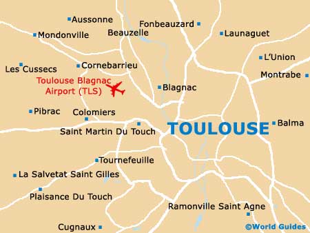
A map is not essential when exploring central Toulouse, with much of the city being clearly signposted and easy to navigate. The main bus station in Toulouse lies to the north-east of the Place Wilson, off the Allées Jean Jaurès. Also within this part of Toulouse is the city's train station, the Gare Matabiau, next to the Canal du Midi.
- Andorra La Vella - 179 km / 112 miles (two hours and 30 minutes, south)
- Auch - 77 km / 48 miles (one hour and 10 minutes, west)
- Bordeaux - 245 km / 152 miles (three hours, north-west)
- Cahors - 112 km / 70 miles (one hour and 30 minutes, north)
- Carcassonne - 94 km / 59 miles (one hour and 15 minutes, south-east)
- Castelnaudary - 59 km / 37 miles (55 minutes, south-east)
- Lourdes - 168 km / 105 miles (two hours, south-west)
- Marmande - 171 km / 107 miles (two hours and five minutes, north-west)
- Mont-De-Marsan - 225 km / 140 miles (two hours and 30 minutes, west)
- Montauban - 53 km / 33 miles (45 minutes, north)
- Montpellier - 241 km / 150 miles (two hours and 30 minutes, east)
- Pamiers - 67 km / 42 miles (55 minutes, south)
- Tarbes - 152 km / 95 miles (one hour and 45 minutes, south-west)
Map of France

Map of Toulouse